
Trending
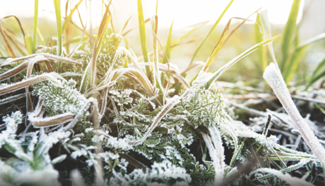
Despite the sunshine and recent warmth, the National Weather Service put a freeze warning in place until 8 a.m. today.
"It is definitely getting late in the season, but it's not too abnormal," said Joe Bauco, a meteorologist with the National Weather Service State College office.
Temperatures were expected to drop to "right around freezing" -- "that could be damaging to some sensitive vegetation," Bauco said, implying the cold could cause trouble for certain crops.
The lowest temperature on record for May 18 is 31, he said, adding today's freeze was caused by a cold dry air mass passing through from the north.
Though a late-season freeze isn't necessarily the type of weather event the average person should stress over, weather experts have some tips on how to be prepared for more severe spring and summer weather disasters.
John Banghoff, another National Weather Service State College meteorologist, said models predict Pennsylvania will experience warmer, wetter conditions this year.
"We're actually transitioning out of what we call La Niña into an El Niño pattern, which is different from what we've had in the last few years," he said. "We would anticipate that warm trend will continue, perhaps the occurrence of more days that are 80 or perhaps even 90 or higher."
And with warmer and wetter weather on the horizon, so too is the possibility of severe weather.
"The frequency and severity of natural disasters are increasing," said a release provided by Eric Feerrar, vice president of travel for AAA North Penn. "In 2018, the United States experienced 14 separate billion-dollar disasters, according to the National Centers for Environmental Information. The years 2016, 2017 and 2018 were historic -- the average number of natural disasters was more than double the long-term average."
Paramount to navigating the various summer weather related hazards is to understand the nature of those hazards, how to prepare for them and what to do in the aftermath.
Start with understanding related public service advisories.
The weather service will begin by issuing an advisory or Hazardous Weather Outlook, which give a general idea of what may occur within the next several hours or days.
If conditions continue to develop that indicate the likelihood of severe weather, a watch is issued.
"A 'watch' is when the conditions exist that could produce the hazardous weather," Banghoff said. "The example that we use may be a little tongue in cheek, but a 'taco watch' would be you have all the ingredients out on your counter. You don't yet have a taco, but you have the conditions that could come together in just the right circumstance. And so when we have a 'watch' out, we encourage folks to just keep an eye on the weather to make contingency plans if you know you may be in a vulnerable situation as far as a 'warning' is concerned."
A "warning" is issued once severe weather is occurring, Banghoff said.
"That's when the ingredients come together, and there's an imminent threat to life and property. In that situation, you've put together your taco, and you are folding the tortilla over on the meat and the cheese and taking a bite out of it, which is a good thing in a lot of cases. Obviously, weather warnings are much more concerning.
"We want to encourage people in a 'warning' situation to take immediate action to protect themselves, because when we have a 'warning' out we're expecting an immediate risk, especially in the spring for damaging winds or hail or flash flooding and things like that," Banghoff said.
Most commonly associated with spring and summer severe weather are thunderstorms. To be deemed a severe thunderstorm, there must be sustained winds of 58 mph or higher and/or hail of one-inch diameter or larger.
On the lower end, these winds can be enough to knock down branches and shallow-rooted trees, possibly resulting in power outages and road hazards.
Straight-line winds of 100 mph, known as downbursts, are easily possible within stronger thunderstorms. Downbursts are often mistaken for tornadoes, with possible damage including roof damage, toppled trees and flipped mobile homes. On the low end, hail that falls from severe thunderstorms is roughly the size of a quarter. Hail of this size is easily capable of damaging property and injuring people, however, hail has been known to reach the size of baseballs, and rarely, even larger than that. Hail of that size can decimate windshields, crops, and in extreme cases, has been known to cause death. Hail damage amounts to nearly one billion dollars annually in the U.S.
"For any thunderstorm, it's going to have lightning," Banghoff says, "and it is not safe to be outside when lightning occurs. So the phrase we use for that is 'When Thunder Roars, Go Indoors.' If you hear thunder, you're close enough to be struck by lightning. So if there's any thunder, we encourage you to delay whatever activities you're doing and seek shelter."
Lightning injures around 3,000 Americans annually -- around 100 of those are fatal.
If lightning appears nearby -- with or without thunder or rain, immediately move indoors. If there is no shelter available, move to a clearing away from trees, which may act as lightning rods. Those out on the water should move immediately to land at the first hint of an impending thunderstorm.
Floods and flash floods kill nearly 100 people, and cause an estimated average of $1 to $3 billion in damage, nationally each year.
There are two types of watches and warnings associated with flooding: flash-flood watches and warnings, and flood watches and warnings. During a flash-flood or flood watch, those in the watch area should gather supplies and prepare for the possibility of a flood. Supplies should include flashlights, non-perishables, and at least a three-day supply of water per person or pet: about a gallon each per day.
An oft-overlooked item to have on hand during flooding -- or any other disaster -- is documentation of vaccination history.
If evacuation is necessary, turn off the main utility power switch and close the main gas valve.
"We encourage people to get to higher ground and never drive through flooded roadways," Banghoff said. "We say 'turn around, don't drown.'"
During and immediately after a flood, avoid using contaminated water supplies for cooking, drinking or brushing teeth. Flood waters often carry disease and chemical contaminants. Stay up to date by listening for boil water advisories. Until the all clear is given, use only bottled, boiled or treated water.
Pennsylvania averages 16 tornadoes per year, but there have been years that saw double that amount or more. This includes the 1985 outbreak, in which 23 tornadoes were recorded within a single day, including two unprecedented F4 tornadoes with winds of 166 to 200 mph as close to the Williamsport area as Watsontown and Moshannon State Forest. That day also included the only F5 to ever strike the state, in Wheatland.
Tornadoes in the state tend to be short-lived and relatively weak, however, that does not mean they are harmless by any stretch. Even weak tornadoes are capable of toppling trees, and flipping improperly secured mobile homes.
"If a tornado warning is issued, we encourage you to go to the lowest floor of the building you're in. So if you have a basement, that's great. If you don't have a basement, we encourage a bathroom or a closet or something that's away from the outside walls," Banghoff said.
Another dangerous aspect of summer weather is excessive heat.
"When there's excessive heat, we will issue advisories, watches or warnings as necessary. And that's usually with heat values pushing 100 or 105 degrees Fahrenheit," Banghoff said. "In those situations, we encourage people to limit their exposure to the heat. Reducing exposure, staying hydrated, wearing light color clothing, and if you have to do work, doing it either in the morning or later in the evening to avoid peak heating are all good tips to keep yourself safe."
Editor Katelyn Hibbard contributed to this report.